Monday, July 3: no driving today, 3850 miles total
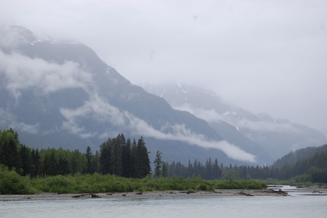
We hung out at Camp LaDaSa for most of the day. For most of the morning we went out on the
lake. Becky and I went out in a canoe
while Marcus, Siena, and Elise took out a little paddle boat. Jacob wasn't feeling well and stayed back at
the cabin. After a little break, the
kids were back out on the lake in the afternoon as well. In the evening we spent some time with the
Warnicks. By midafternoon the rain
finally went away.
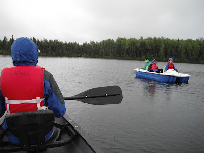 |
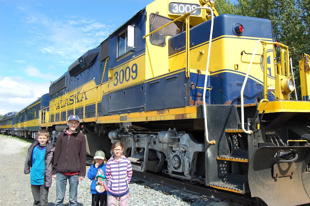
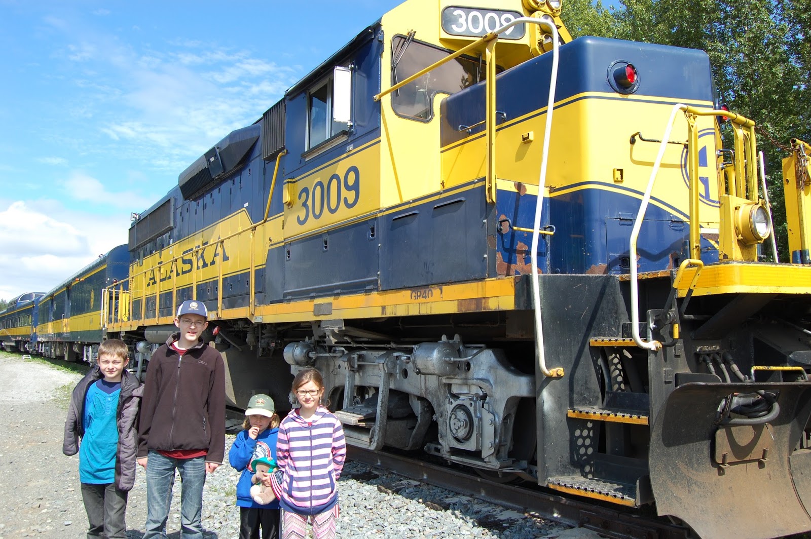
| Out on the lake at Camp Ladasa |
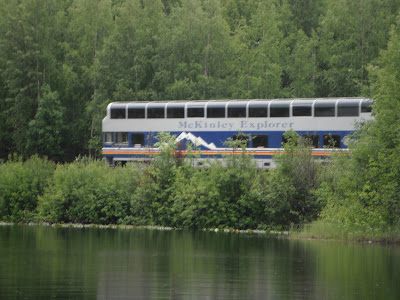 |
| Passenger train going through camp |
Tuesday, July 4: 3 hours drive time, 258 miles, 4108 miles
total
We said goodbye to the Warnicks and Camp LaDaSa. Our first stop was the little town of
Talkeetna, which is 14 miles off of the main Parks Highway. It just so happened that we arrived right at
noon, just before the start of their big 4th of July parade. It was a neat little parade, and almost every
entrant in the parade had some sort of decorated moose. After the parade we walked around the small
town and looked at some of the shops. We
even tried a sample of Fireweed ice cream (it had a berry flavor). Since it was the 4th, the town was packed
with tourists and lots of locals. We
decided to skip out on all of the celebrations and hit the road.
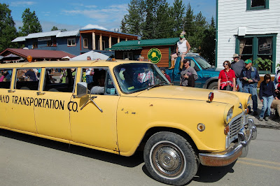 |
| Talkeetna 4th of July Parade |
We drove the next two hours and arrived at Denali
National Park. After finding a campsite
right outside the park, we drove into the park to look at the visitors center
and pick up our shuttle bus tour tickets for the next day (we ordered them a
few days prior, since these can fill up fast).
We then drove the first 15 miles of the park road to the Savage
River. This is the only part of the park
road that most people are allowed to drive.
We then headed back to our camp at Grizzly Bear Park. We chose a walk-in site right alongside the
Nenana River. This meant we had to haul
all of our gear down to our site, but it was completely worth it, since we were
right on the river and had few people camped around us. The kids also liked playing along the
river.
 |
| Camping along Nenana River |
Wednesday, July 5: 12 miles, 4120 miles total
First we headed into the tourist area just outside the park
to look around at all the shops. We then
went over to the Wilderness Access Center to catch our shuttle bus into the
park. The green shuttle buses are a
nice way to get deep into the park, since cars are only allowed on the first 15
miles of the 90 mile park road. Though
these are not the narrated, fancy tour buses, the drivers do a somewhat
running narration as you go through the park.
Also, whenever someone sees wildlife along the road, all they need to do
is yell "stop", and the driver will very quickly slam on his
brakes. Also, since it is a shuttle, you
can get on and off the buses anywhere along the road and catch another bus
later.
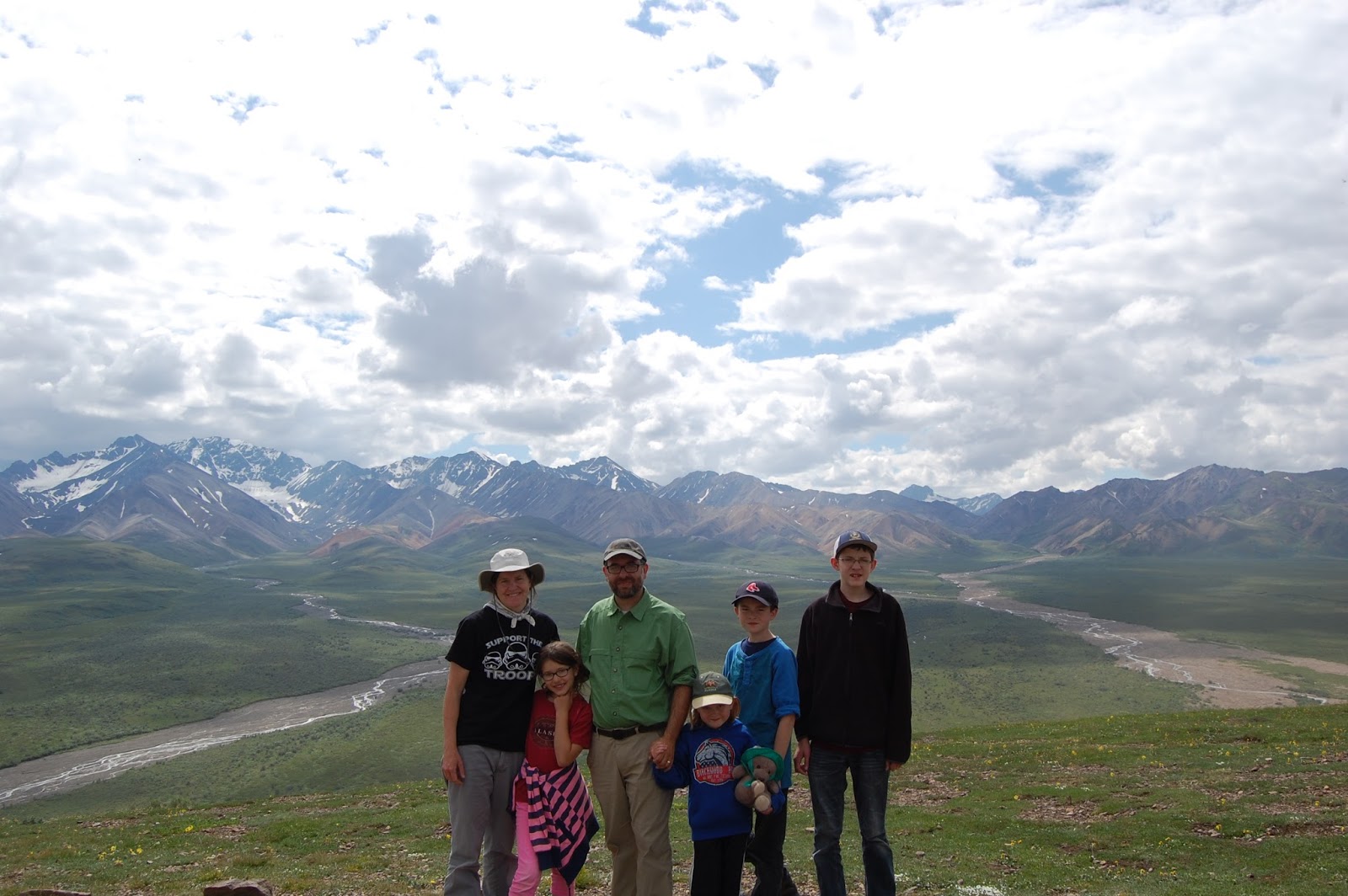
It took us a little shy of four
hours to reach the Eielson visitors center, which is 60 miles into the
park. Along the way we saw moose,
several caribou, and grizzly bears. One
grizzly was right along the edge of the road and slowly made its way toward the
back end of the bus, continuing to eat along the edge of the road. At one point it was no more than 10 feet from
us! There are several points along the
road that you can see the mountain, Denali (used to be Mt. McKinley), if it is
clear. Unfortunately, on average in the
month of July the mountain appears out of the clouds for only two days, and
ours was not one of them! The view along
the drive was amazing, nonetheless.
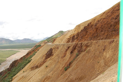 |
| Road over Polychrome Pass |
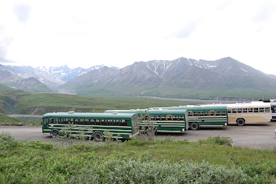 |
| Shuttle buses |
 |
| Going over Polychrome pass |
 |
| Caribou |
Once
we arrived at the Eielson visitors center, we looked around, then decided to
hike up to a peak above the visitors center.
The trail climbed roughly 800 feet in a little over a half
mile. Once we got to the top we had
amazing 360 degree views of the park.
For a second some of the clouds around the mountain opened up and we
thought we saw just a glimpse of the mountain.
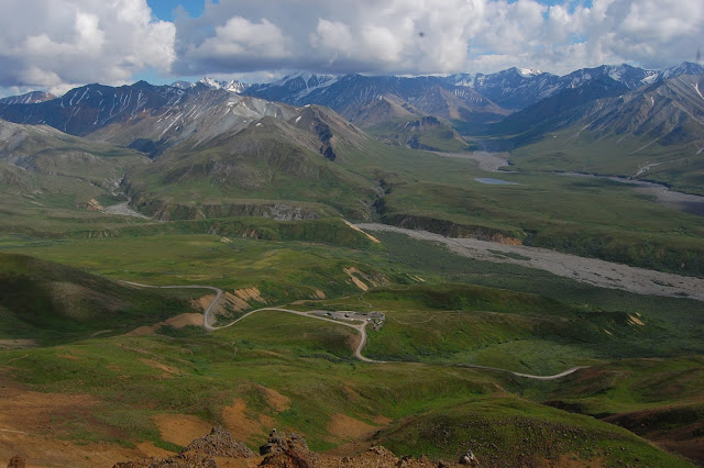 |
| Looking down toward the visitors center from the top |
 |
| We hiked up to the top of the peak |
We hurried back down and were fortunate enough to catch the 6pm shuttle
heading back out of the park. Our three
hour drive back wasn't as filled with wildlife viewings, though we did see more
caribou. Since it was later in the day,
the mountains were amazing with the better lighting. When we arrived back at the Wilderness Access
Center around 9pm, there was a moose cow with two calves right outside the
door, munching on the bushes.
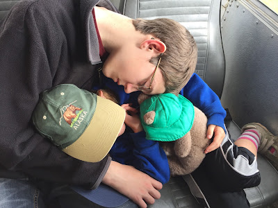 |
| The long bus ride back |
Thursday, July 6: 2 hours drive time, 152 miles, 4,272 miles
total
This morning we went back into Denali NP to see the sled dog
demonstration. Even though it was brief,
it was still impressive to see how strong and fast the dogs are. After the demonstration, we were able to walk
around and pet some of the dogs. The
kids thought this was really cool. We
then got in the car and drove the two hours north to Fairbanks. We found a campsite right in town and then
went to get our oil changed. It got up
to 90 degrees in Fairbanks, which is a lot hotter than our weather the last two
weeks, which has been averaging highs in the mid 60's. We went back to our campsite to sit in the
shade and relax.
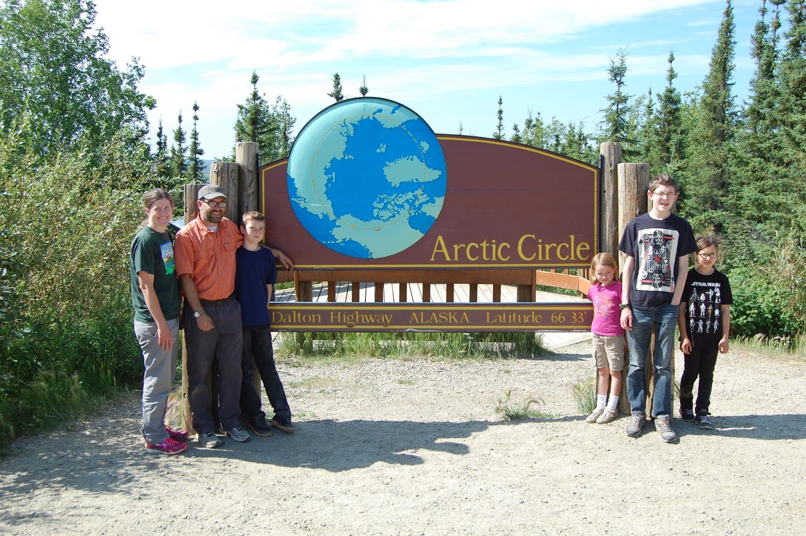
Friday, July 7: 10.5 hours drive time, 406 miles, 4,678
miles total
We got an early start this morning as we left Fairbanks and
headed north 85 miles to drive the Dalton Highway up to the Arctic
Circle. The Dalton is 425 miles long,
ending at Deadhorse up at the Arctic Ocean.
We were only going 115 miles up the road. Most of the road is gravel, with a few paved
sections (though the paved sections are almost worse than the gravel due to
frost heaves and deep potholes). This is
the main supply route to the oil fields up at Prudhoe Bay, so there are a lot
of semi trucks on the road, but most were very courteous and didn't throw
gravel on your car as they passed. The
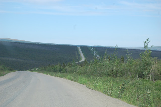
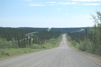
road also follows the Alaska Pipeline for most of the way, so we got some cool
views of that as well.
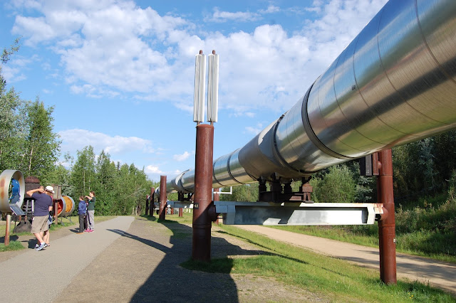 |
| Alaska Oil Pipeline |
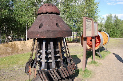 |
| Pigs used in the pipeline |
There isn't much
at all in terms of civilization on most of the Dalton, and there isn't anything
at all except wilderness on both sides as far as you can see. Since the Dalton is mostly gravel and
potholed, the road is notorious for flat tires.
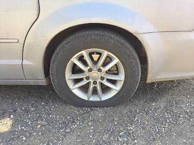
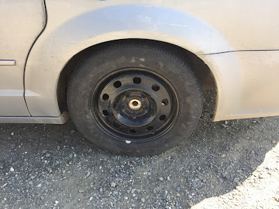
And around the 100 mile mark we got one.
Luckily, we thought about this before we left home and brought a full
size spare with us in addition to our smaller one under the car. It was definitely cheaper to buy a full size
spare for $100 than having to pay for a tow truck, which can run anywhere from $5-10
per mile (you do the math).


After a
quick tire change, we drove the last 15 miles to the Arctic Circle. We got our pictures taken next to the sign
and even got certificates saying we had been there, done that. We then turned around and started our trip
back south. Right before the end of the
Dalton it started to rain really hard. Fortunately
we were done with the road, since the Dalton can get real nasty when wet. It poured almost the whole 85 miles back to
Fairbanks. We found a campsite and took the kids for burgers, since they were
very patient sitting in the car for a bumpy 10 and a half hours.
 |
| Our turnaround point to start heading back south |
Saturday, July 8: 8.5 hours drive time, 407 miles, 5,085 miles
total
I got up early this morning to take the van in and get our
flat tire repaired. After a quick
breakfast and cleanup, we drove a few minutes down the road to North Pole, Alaska. The kids were able to mail a few postcards
from the post office. We then drove over
to the Santa Claus house and looked around a bought a few things.
Then it was back to the car for several hours
as we drove the Richardson Highway south toward Tok. Just after Tok we turned east and started up
the Taylor Highway. After about an hour
we arrived in the very small town of Chicken.
We looked around (didn't take very long) and took some pictures with the
chicken statues.
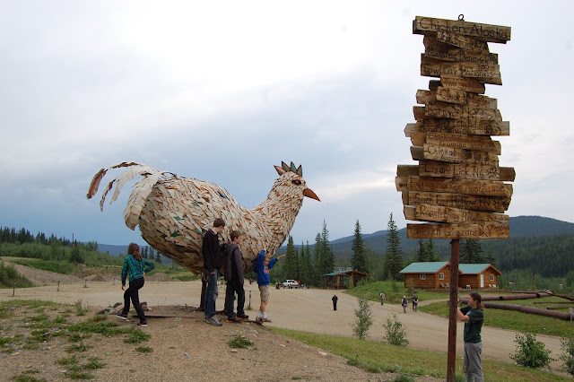 |
| Chicken, Alaska |
From there the road was
mostly dirt with rain all the way to the Canadian border. We then drove on the Top of the World
Highway, which has some amazing views.
The rain finally stopped, but the road was still pretty muddy. Our car wasn't completely covered, but did
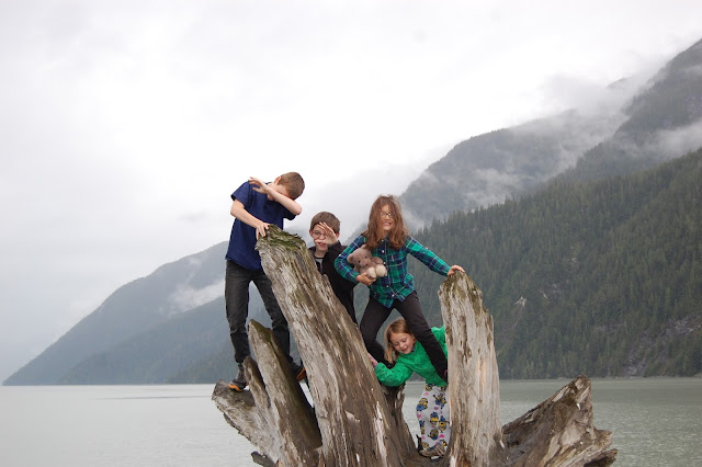
finally look the part of a car driven off-road in Alaska. We pulled into the Yukon River Crossing campground
that sits on the opposite side of the Yukon River from Dawson City. The kids were excited because firewood is
free at Yukon Government campgrounds, meaning we could finally have a
campfire. A few of us walked down to
watch the free car ferry cross over the river to Dawson City.
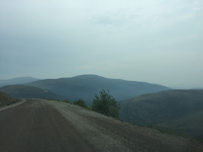 |
| Top of the World Highway |
 |
| Camping along the Yukon River |
 |
| Playing by the Yukon River at 11 pm in full daylight |
Sunday, July 9: 4.5 hours drive time, 275 miles, 5,360 miles
total
Since we stayed up late last night, everyone slept in
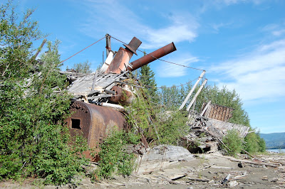
late. After breakfast we went for a walk
downriver from our campground to a paddlewheel grave yard. There were at least four old paddlewheel
boats that had been drydocked along the Yukon and left to rot. There wasn't much of some of them, but it was
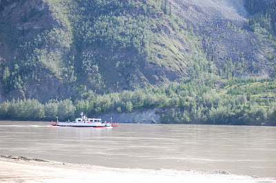
cool to look at. We then drove over and
took the free car ferry across the Yukon River over to Dawson City. Fortunately we only had to wait about 15
minutes to catch the ferry. The
northbound side had a huge lineup of cars, mostly RVs. Since the ferry can only hold one RV and a
few cars at a time, some of those people probably were looking at a 3 hour wait
time.
 |
| Old Paddlewheel boats left along the Yukon River |
 |
| Car ferry across the Yukon River over to Dawson City |
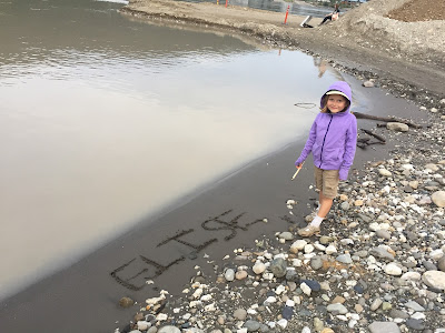
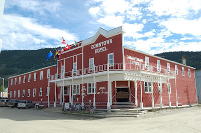
We wandered around Dawson City and
looked at all the old buildings. The whole
city is set up to look like the old gold rush town that it was. The streets are all dirt and there are
boardwalks instead of sidewalks. We went
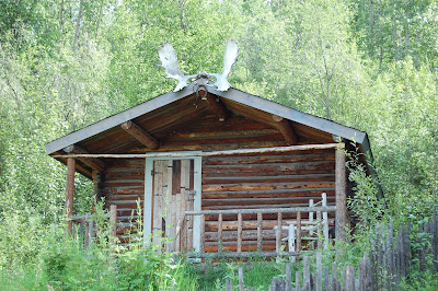
over and visited the cabins of the poet Robert Service and the author Jack
London.
 |
| Dawson City, Yukon Territory |
 |
| Poet Robert Service's Cabin |
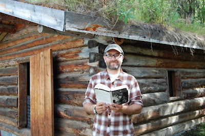 |
| Reading "White Fang" at Jack London's cabin |
We then drove a few miles south
of town to the original gold strike and then to an area where there was free
gold panning on a claim owned by the Yukon government. We brought along our own gold pan and
shovel. No one struck it rich, but the
kids had fun trying. There was a ton of
fool's gold in the river, so every 30 seconds or so the kids thought they had
hit the mother lode! Once we realized
our future was not in the gold panning business, we hit the road again and
drove south toward Whitehorse. We ended
up camping at a nice little campground called Twin Lakes. Since it is a Yukon Government campground, we
were able to have another campfire with free firewood.
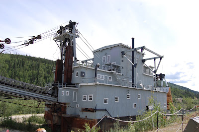 |
| Gold Dredge |
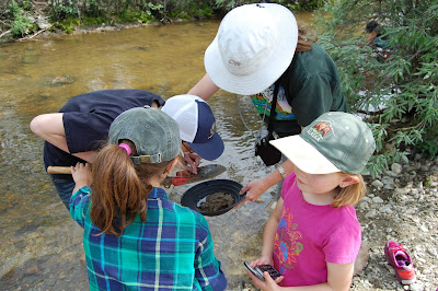 |
| Panning for gold |
Monday, July 10: 7.5 hours drive time, 430 miles, 5,790
miles total
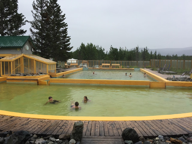
This morning we stopped at Takhini Hot Springs, which are
about 20 miles outside of Whitehorse.
Since it was early in the morning and raining, we had most of the place
to ourselves. We also took advantage of
the showers, since it had been awhile since all of us had cleaned up. We hooked back up with the Alaska highway for
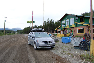
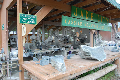
a few hours, then headed south on the Cassiar Highway. We camped for free at a place called Jade
City, which is famous for mining all of the Jade in the area. It was 43 degrees when we got there and
raining. There was fresh snow not too
far up the mountains. It was our coldest
night on the trip.
 |
| Takhini Hot Springs outside of Whitehorse, Yukon Territory |
 |
| Jade City |
 |
| Cutting Jade |
Tuesday, July 11: 10.5 hours drive time, 489 miles, 6,279
miles total
We packed up and continued on down the Cassiar Highway. The Cassiar is more remote than the Alaska
Highway (which has its own remote parts).
During the day we saw 12 black bears along the road, though these bears
were very skittish compared to the others we have seen. We took a side trip and drove to Stewart,
B.C. and Hyder, Alaska. The 40 mile
drive passed through the Coastal range and the scenery was beautiful! We hoped to go out and see the bears fishing
for Salmon in Hyder, but unfortunately the salmon weren’t running yet. We drove
back to the Cassiar Highway and then headed East on the Yellowhead Highway. We ended up camping at Seely Lake. There were lots of mosquitos! We quickly ate and jumped in the tent to get
out of the rain and the swarms of mosquitos that were eating us alive!
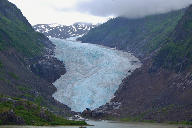 |
| Bear Glacier, on the drive to Stewart B.C. and Hyder, Alaska |
 |
| Hyder, Alaska |
Wednesday, July12: 12.5 hours drive time, 637 miles, 6,916
miles total
The mosquitos were just as bad this morning. We drove East toward Prince George. We had heard earlier that there are wildfires
along highway 97 south of Prince George and the highway was closed. When we got to Prince George we found out
that this was true, so we continued to head East, and then turned south, right
before Jasper National Park in the Canadian Rockies. This was our only way to head south, and it
was quite a long detour! We pushed on
down Highway 5, passing several smaller wildfires along the way. We kept driving until we were out of the
smoky conditions.
Thursday, July 13: 9.5 hours drive time, 470 miles, 7,386
miles total
We continued to make our way south through Kamloops and then
head back into the U.S. and down the Okanogan Valley. The temperature outside continued to rise and
we weren’t too excited to be back in the heat.
The kids were really excited to be back home!
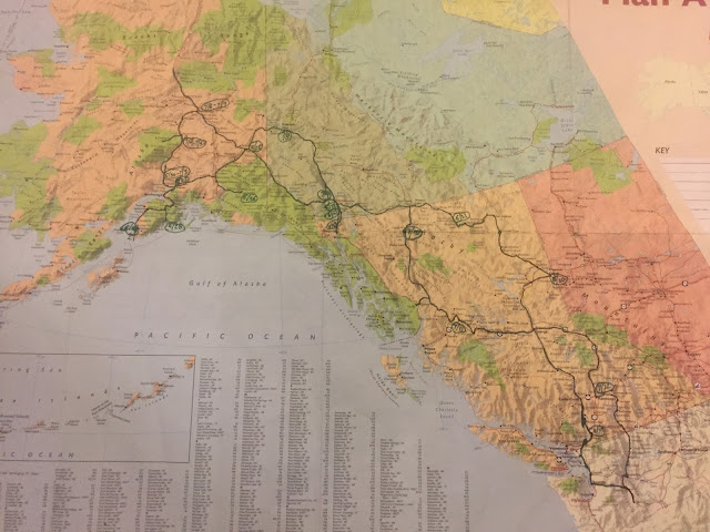 |
| Our complete route mapped out. |


Wow great trip...just seeing this now...summer 2018...
ReplyDelete